✨ This article was AI edited. Editorial responsibility: BelizeanStudies.com.
Produced with AI. This article was artificially generated. Editorial responsibility: BelizeanStudies.com.
If you are planning your next tropical getaway or exploring retirement destinations in the Americas, one fundamental question comes first: Where is Belize located on the world map? Known for its pristine turquoise waters, lush virgin rainforests, and the world-famous Great Blue Hole, Belize occupies a strategic and breathtaking position at the crossroads of Central America and the Caribbean.
In this detailed geographic guide, we map out Belize’s exact global coordinates, explain its dual Central American and Caribbean identity, break down its six distinct administrative districts, and provide practical travel times from major international hubs.
Global Coordinates and Bordering Countries
Belize is situated on the eastern coastline of Central America, directly on the shores of the Caribbean Sea. Geographically, it forms the southeastern base of the Yucatan Peninsula.
- Geographic Coordinates: Approximately 17°15′ North latitude and 88°45′ West longitude.
- Northern Border: Bounded by the Mexican state of Quintana Roo (border crossing near Chetumal).
- Western and Southern Borders: Encircled by the departments of Petén and Izabal in Guatemala.
- Eastern Coastline: Fronts over 240 miles (386 km) of the Caribbean Sea, sheltered by the second-largest barrier reef system in the world.
Covering a total land area of approximately 8,867 square miles (22,966 square km), Belize is roughly the size of the state of Massachusetts or the country of Wales. Despite its compact size, it boasts an astonishing diversity of ecosystems—from highland pine ridges and tropical jungle river valleys to offshore coral atolls.
| Geographic Parameter | Belize Metric / Details | Global Context |
|---|---|---|
| Continent / Region | North America / Central America | Caribbean Basin |
| Total Land Area | 22,966 km² (8,867 sq mi) | Second smallest country on mainland Central America |
| Coastline Length | 386 km (240 miles) | Caribbean Sea / Gulf of Honduras |
| Highest Elevation | Doyle’s Delight (1,124 m / 3,688 ft) | Located in the Maya Mountains (Cayo / Toledo border) |
| Barrier Reef Length | 300 km (185 miles) | Part of the 1,000 km Mesoamerican Barrier Reef |
| Capital City | Belmopan | Built inland following Hurricane Hattie (1961) |
Is Belize in Central America or the Caribbean?
One of the most common points of confusion for travelers is Belize’s geopolitical identity. The simple answer is: Belize is geographically in Central America, but culturally, historically, and politically aligned with the Caribbean.
Central American Geography
Physically attached to the North American continent and nestled between Mexico and Guatemala, Belize shares contiguous land borders, wildlife corridors (such as the Maya Forest Corridor), and ancient Maya archaeological heritage with its Central American neighbors.
Caribbean Soul & Institutional Ties
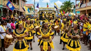
Because of its British colonial past, English language, and maritime heritage, Belize is a founding member of CARICOM (the Caribbean Community) and the Commonwealth of Nations. Its musical styles (Punta, Reggae, Soca), cuisine (rice and beans in coconut milk), and relaxed coastal lifestyle mirror Jamaica, Trinidad, and Barbados far more than the interior highlands of Central America.
The Six Districts of Belize: Regional Breakdown
Belize is divided into six administrative districts, each offering unique terrain, climates, and travel attractions:
| District | Major Towns / Islands | Landscape Highlights | Top Travel Attractions |
|---|---|---|---|
| Belize District | Belize City, San Pedro (Ambergris Caye), Caye Caulker | Coastal plains, mangroves, world-famous offshore coral cayes | Hol Chan Marine Reserve, Shark Ray Alley, Great Blue Hole |
| Cayo District | San Ignacio, Santa Elena, Belmopan | Maya Mountains, pine ridges, limestone caves, rushing rivers | ATM Cave (Actun Tunichil Muknal), Xunantunich, Mountain Pine Ridge |
| Stann Creek | Dangriga, Placencia, Hopkins | White sand beaches, citrus orchards, coastal savannah | Cockscomb Basin Wildlife Sanctuary (Jaguar Reserve), Placencia Village |
| Toledo District | Punta Gorda | Dense tropical rainforests, cacao plantations, Maya villages | Lubaantun, Nim Li Punit, Blue Creek Cave, traditional chocolate tours |
| Orange Walk | Orange Walk Town | New River basin, sugar cane fields, tropical lagoons | Lamanai Archaeological Reserve (river safari approach) |
| Corozal District | Corozal Town, Sarteneja | Calm turquoise bay, coastal fishing villages, fertile plains | Santa Rita Maya Ruin, Cerros, easy border access to Chetumal (Mexico) |
The Belize Barrier Reef and Offshore Cayes
Stretching parallel to Belize’s coast lies the crowning jewel of its geography: the Belize Barrier Reef. Comprising seven protected marine reserves designated as a UNESCO World Heritage site, the reef is home to over 500 species of fish, 65 varieties of coral, and rare marine mammals including the West Indian manatee.
Belize features over 450 offshore islands (called cayes) and three of the Western Hemisphere’s only four coral atolls:
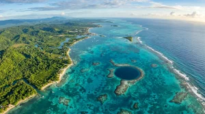
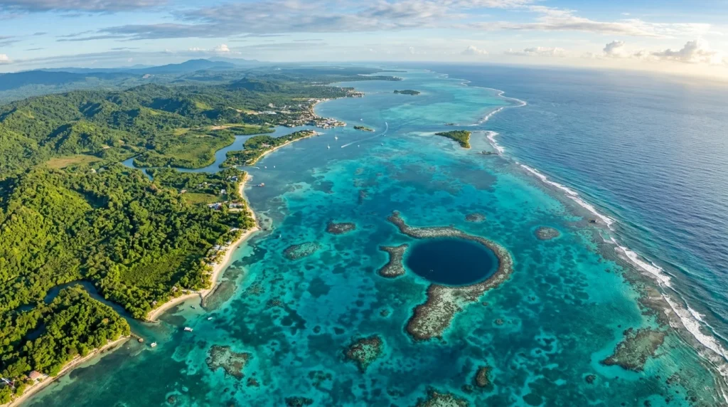
- Lighthouse Reef Atoll: Home to the iconic Great Blue Hole, a 407-foot deep underwater sinkhole made famous by Jacques Cousteau.
- Turneffe Atoll: The largest coral atoll in the Americas, renowned for flats fishing (bonefish, tarpon, permit) and world-class wall diving.
- Glover’s Reef Atoll: A remote marine reserve with shallow turquoise lagoons and thriving dive walls.
How to Get to Belize: Flight Times and Travel Logistics
Belize is easily accessible via the Philip S.W. Goldson International Airport (BZE) located in Ladyville, just 10 miles north of Belize City. Direct flights connect Belize with several major North American gateway cities:
- Miami (MIA) / Fort Lauderdale (FLL): ~2 hours direct flight.
- Houston (IAH / HOU): ~2.5 hours direct flight.
- Dallas-Fort Worth (DFW): ~3 hours direct flight.
- Atlanta (ATL): ~3 hours direct flight.
- Charlotte (CLT): ~3.5 hours direct flight.
- Cancun (CUN): Short hopper flight or 5-hour ADO luxury bus to the northern Belize border.
Frequently Asked Questions
Is Belize considered safe for international tourists?
Yes. The vast majority of tourist destinations—including Ambergris Caye, Caye Caulker, Placencia, Hopkins, and San Ignacio—are exceptionally safe, peaceful, and welcoming. Standard travel precautions apply, especially when navigating non-tourist neighborhoods of southside Belize City at night.
What currency is used in Belize?
The official currency is the Belize Dollar (BZD), which is legally pegged to the US Dollar at a fixed rate of $2 BZD = $1 USD. US Dollars are accepted everywhere in Belize.
Does Belize share a land border with Mexico?
Yes. Belize shares a northern border with the Mexican state of Quintana Roo near the city of Chetumal, with modern customs facilities for both vehicles and pedestrians.
What is the time zone in Belize?
Belize is in the Central Standard Time (CST) zone (UTC-6) year-round. It does not observe Daylight Saving Time.
Get our latest guides, news, and insights highlighted in your Google Search & AI Overviews.