Nestled in the heart of Central America, Belize boasts a dotted border that not only intrigues travelers but also reflects its rich and complex history. This unique geographical feature invites questions: why does it look this way, and what does it signify about the nation’s past and present? Understanding the origins of Belize’s dotted border sheds light on the broader themes of identity, territorial disputes, and cultural fusion that characterize this vibrant nation. As you delve into this geographic mystery, you’ll uncover how the interplay of historical events has shaped Belize into the diverse and alluring destination it is today. Join us on this journey of discovery that promises to enhance your appreciation of Belize’s stunning landscapes and cultural heritage!
The Historical Context of Belize’s Dotted Border
Throughout its history, Belize has navigated a complex web of territorial claims and agreements that have shaped its unique border, a dotted line on maps that reveals much about the nation’s past. The current border delineations reflect a legacy of colonial treaties, territorial disputes, and diplomatic negotiations that date back centuries. These dotted borders symbolize not only physical separations but also the evolving identity of a nation marked by cultural convergence and historical contestations.
The genesis of Belize’s border can be traced back to the early European colonizers who arrived on the Caribbean shores, primarily the British and Spanish. The Treaty of Madrid in 1783 established boundaries between British Honduras (now Belize) and the Spanish territories to the west. Subsequent treaties, including the 1893 Anglo-Guatemalan Treaty, further defined these borders, yet still retained ambiguity, particularly in areas that now make up Guatemala’s modern borders. The gradual evolution of these agreements was influenced by both colonial interests and the pressure of indigenous populations who occupied these lands long before European powers laid claim.
Belize’s dotted border has also been influenced by its rich geographical features-dense rainforests, rivers, and mountains all complicate precise demarcations. For instance, vast swaths of jungles and rivers not only provide natural barriers but also form a backdrop for ongoing cross-border interactions, affecting social and economic dynamics between Belize and its neighbors, such as Guatemala and Mexico. These geographical features have played a pivotal role in both defining and sometimes obscuring the realities of border management, prompting a blend of cooperation and conflict throughout history.
In summary, is a reflection of its colonial past, geographical intricacies, and the cultural mosaic that defines its people today. Understanding this context not only provides insight into national pride and identity but also highlights the ongoing challenges and dialogues in Belize’s relationships with its neighbors. As you venture through Belize, keep an eye on the horizon; the shifts from sea to sky, the interfaces of land and people, all echo the deep-rooted stories of a nation that’s continuously finding its place on the map.
Understanding the Significance of Belize’s Border
Enigmatic and dotted, Belize’s border serves as a living testament to the country’s rich tapestry of history, culture, and geography. This delineation, which appears as a mere series of lines on a map, holds profound significance, representing not just geographical demarcation but also the intricate relationships and dialogues Belize shares with its neighbors. The history behind this dotted border reveals a narrative of colonial legacies, cultural exchanges, and enduring aspirations for national identity.
The significance of Belize’s border can be traced through the lens of its colonial past, which shaped the territorial realities that exist today. Originally part of British Honduras, Belize’s boundaries were crafted through a series of colonial treaties, each influencing the nation’s identity and aspirations. The impact of these historical agreements continues to resonate, guiding Belize’s interactions with Guatemala and Mexico, both geographically and politically. Visitors exploring Belize’s diverse landscapes can sense the fluidity of these borders, particularly in regions where cultural and linguistic identities blur the lines drawn by mapmakers.
Moreover, Belize’s geographical features contribute uniquely to the significance of its border. The lush rainforests, meandering rivers, and majestic mountains not only serve as barriers but also foster cross-cultural exchanges between local communities. This natural landscape invites travelers to experience the vibrant life that flourishes beyond borders, evident in the thriving trade, familial ties, and shared festivals across the region. For example, relishing in Creole cuisine on the Belizean side of the border may evoke flavors reminiscent of neighboring Guatemala, encapsulating the shared heritage that transcends artificial divisions.
Ultimately, the dotted border of Belize encapsulates an ongoing story of cultural resilience and transformation. As Belizeans continue to navigate the complexities of their national identity, understanding the significance of this border invites deeper appreciation for the cultural mosaic that defines this stunning Central American destination. For those embarking on this journey, the embrace of Belize’s natural beauty and rich history offers both an adventure and an invitation to connect with the heart of a nation defined by its landscapes, its people, and the ever-evolving narratives that connect them.
The Role of Colonial Treaties in Border Formation
Throughout history, the borders of Belize have been shaped by a series of colonial treaties that not only defined territorial boundaries but also left a lasting imprint on the cultural and political landscape of the nation. At the heart of this history lies the transition of Belize from British Honduras to an independent nation, reflecting the intricate dance of diplomacy and power that characterized colonial rule in Central America. The dotted lines marking Belize’s borders are not merely cartographic symbols; they are the result of negotiations, conflicts, and treaties that have influenced how Belizeans perceive their identity and relationships with their neighbors.
Primarily, the boundaries of Belize were established through key treaties between colonial powers. The 1859 Treaty between the United Kingdom and Guatemala is particularly significant, as it sought to clarify Belize’s borders and solidify British interests in the region. This treaty included provisions that recognized Guatemala’s territorial claims surrounding British Honduras, which planted seeds for future disputes. Furthermore, the Cession of the Bay Islands in 1860 and subsequent negotiations over territorial rights highlighted the vulnerabilities Belize faced as it existed on the fringes of larger colonial ambitions.
The impact of these colonial treaties is palpable not just in historical context but also in contemporary Belizean society. For travelers exploring the scenic landscapes of Belize, it becomes evident how geography and history intertwine. Whether wandering through bustling markets in Corozal or engaging in community festivals near the Guatemalan border, the palpable cultural nuances resonate deeply within the shared histories of these nations. The reverberations of the treaty negotiations continue to echo, as Belize navigates complex relationships with neighboring Guatemala and Mexico, often involving discussions over land, resources, and national pride.
In essence, the role of these colonial agreements in the formation of Belize’s dotted borders underscores a narrative of resilience and adaptation. As you journey through Belize’s breathtaking rainforests, ancient Maya ruins, and stunning coastlines, consider how these landscapes have witnessed not just natural beauty but also the evolution of a national identity forged in the crucible of colonial treaties. This understanding enriches your experience, illuminating the diverse cultural tapestry that is both a product of its historical foundations and a seemingly fluid reality shaped by the people who call this vibrant nation home.
Geographical Features that Influence the Border
The vibrant landscapes of Belize provide more than just breathtaking vistas; they also play a crucial role in defining the country’s uniquely dotted borders. Nestled between the Caribbean Sea to the east and the dense jungles to the west, Belize’s geographical features are key to understanding how its borders have evolved over time. From river systems to mountain ranges, every natural feature has contributed to the complex tapestry of Belizean territorial delineation.
In particular, the dense rainforests and winding rivers that characterize much of Belize serve as natural barriers, influencing how boundaries were drawn. The Maya Mountains, which run diagonally through the country, present a formidable obstacle that has historically complicated delineation efforts. Their rugged terrain has made surveying and boundary enforcement challenging, leading to the dotted representation often used in maps to denote disputed areas. The Cayo District, with its intricate network of rivers, is another area where natural features impact the perception and definition of borders, providing navigational challenges and influencing settlement patterns.
Furthermore, Belize’s coastal location along the Caribbean has made it vulnerable to maritime disputes, complicating its maritime boundaries with neighboring countries. The barrier reefs and numerous cayes not only enhance the nation’s ecological richness but also shape its territorial waters, leading to ongoing discussions about fishing rights and resource management. This layered relationship between geography and boundary creation has not only shaped Belize’s political landscape but has also influenced its cultural interactions with neighboring nations such as Guatemala and Mexico.
As you explore Belize’s breathtaking landscapes-whether kayaking through pristine lagoons, hiking the trails of the Maya Mountains, or snorkeling off the coast-consider how these natural features play a vital role in the story of the nation’s borders. Each step taken amidst the lush jungles or along the serene beaches is a reminder of the geographical narratives that have historically defined and continue to delineate this remarkable Central American gem.
Cultural Impacts of a Dotted Border on Belizeans
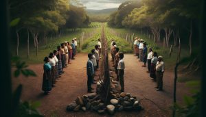
The dotted borders that characterize Belize hold deep cultural significance for its people, weaving a rich tapestry of identity, history, and community dynamics. This unique delineation not only influences geopolitical relationships but also punctuates everyday life for Belizeans. As you traverse this vibrant country, you’ll encounter how its ambiguous borders shape local customs, traditions, and cross-border interactions, reflecting a communal spirit amidst diverse cultures.
Belizeans often celebrate their rich heritage through cross-cultural festivals, many of which blossom along the borders, where communities intertwine. For instance, the Garifuna settlement in southern Belize forms a cultural bridge with neighboring Honduras, showcasing vibrant music, dance, and culinary practices that transcend formal boundaries. Such interactions foster a sense of belonging, allowing individuals to navigate shared cultural practices rather than be confined by rigid demarcations.
Moreover, the dotted borders impact economic activities, particularly in areas such as trade, fishing, and tourism. The lively markets in border towns thrive on a blend of local and foreign goods, where Belizeans and neighboring communities interact seamlessly. This cross-border exchange enriches culinary landscapes, introducing varieties like fresh seafood and spices, which often blend traditional Belizean dishes into delightful fusions that reflect the region’s cultural melting pot.
Finally, the dotted borders also serve as a backdrop for environmental consciousness. Local communities recognize the importance of preserving their shared ecosystems, which extend across national lines. Collaborative conservation efforts between Belizeans and their neighbors work towards sustainable management of natural resources, helping to protect fragile environments like the barrier reef and rainforest regions that are integral to their shared heritage.
In summary, the cultural impacts of Belize’s dotted borders are profound, influencing everything from local identities and traditions to economic interdependence and environmental stewardship. These borders, though politically defined, ultimately enhance the rich, interconnected tapestry of life in Belize, celebrating diversity while fostering unity.
How Geography Shaped Belize’s Relationships with Neighbors
The intricate landscapes of Belize are not just a backdrop; they are the very fabric that weaves together the relationships between Belize and its neighboring countries. The juxtaposition of lush jungles, meandering rivers, and the Caribbean coastline creates a vibrant setting where geography plays a pivotal role in shaping cultural, economic, and political interactions. This diverse terrain is not merely physically defining but also influences how communities connect across borders, fostering relationships that thrive on shared resources, traditions, and environmental challenges.
Cultural Exchange and Cross-Border Relationships
The proximity of Belize to both Mexico and Guatemala facilitates an ongoing exchange of cultural influences. The geographical features, such as the wide expanses of the Maya Mountains and the rich biodiversity of the tropical rainforests, serve as natural meeting points where traditions and practices intermingle. The festivals celebrated in Belize often reflect this rich cultural fabric, with elements derived from neighboring countries enriching local customs. For example, the Garifuna culture, prevalent in southern Belize, has deep ties to communities across the borders, exemplifying how shared linguistic and culinary traits foster a sense of unity alongside national identities.
Economic Interdependence Driven by Geography
Geography also plays a significant role in the economic landscape of Belize. Border towns like Corozal and Benque Viejo del Carmen act as vibrant trade hubs where goods flow seamlessly across the borders. The diverse geographical features not only present challenges but also opportunities, enabling industries such as ecotourism and agriculture to flourish. The fertile lands near the borders allow Belizean farmers to engage in cross-border trade, swapping natural produce for goods from neighboring regions. Establishing relationships built on economic interdependence, these exchanges not only bolster local economies but also create a shared responsibility for sustainable practices.
Environmental Considerations of Shared Geography
The natural borders formed by rivers and mountains extend beyond political delineations, making environmental preservation a shared endeavor for Belize and its neighbors. Joint conservation initiatives aimed at protecting biodiversity hotspots, such as the majestic barrier reef and the irreplaceable rainforests, highlight the interconnectedness of these nations. The geographical layout necessitates collaboration that transcends national boundaries, as fragile ecosystems require collective stewardship. Conservation efforts often invite participation from locals on both sides, cultivating a strong sense of ownership and shared purpose that strengthens bilateral relations.
In essence, the geography of Belize has intricately sculpted its relationships with neighboring countries, fostering cultural exchanges, economic partnerships, and collaborative environmental efforts. As travelers explore this wondrous country, they not only navigate varied landscapes but also experience the profound influence of geography on the communal identity that defines Belizean life.
The Evolution of Border Definitions Over Time
The boundaries that define Belize today are a tapestry rich with history, marked by a series of treaties, conflicts, and negotiations that shaped its identity. Delving into the evolution of border definitions offers insights not only into the geopolitical landscape of the region but also into the cultural narratives that have unfolded over centuries. Belize’s dotted border, often seen as an informal and variable line, is a reflection of its historical challenges and the lived realities of its diverse population.
Throughout colonial history, treaties such as the 1859 Anglo-Guatemalan Treaty became pivotal. This agreement sought to finalize the boundaries between British Honduras (now Belize) and Guatemala, yet it has led to ongoing disputes and a degree of ambiguity that still characterizes the border today. Geographic features like rivers and mountain ranges were often used as natural markers, yet their fluid nature-shaped by the environment-challenge the rigid definitions typically associated with nation-states. This has resulted in a dotted border that represents both the physical and cultural realities of living in a region where geography, history, and identity converge.
In modern times, the dotted border transcends mere cartography. It embodies the intermingled lives of people on both sides-exchanging cultural practices, economic activities, and environmental responsibilities. For instance, shared ecosystems along the border have led to collaborative conservation efforts, emphasizing a unified approach toward the preservation of biodiversity. As the evolution of these border definitions continues, so too does the need for cooperative relationships between Belize and its neighbors. This vibrant interplay between history and geography not only underscores the complexity of Belize’s borders but also highlights the dynamic cultural landscape that thrives in this Central American gem.
In recognizing the nuances of Belize’s evolving borders, travelers and expats alike can appreciate the beauty of a nation shaped by its historical complexities, offering a unique opportunity to engage with a culture defined by resilience and adaptability. From exploring the lush jungles and pristine coastlines to witnessing the lively interactions in border towns, the experience is enriched by an understanding of the greater narrative that defines Belizean life.
Visualizing the Border: Maps and Geospatial Analysis
In the enchanting landscape of Belize, where lush jungles meet the azure Caribbean Sea, the concept of borders takes on an intriguing character, often materializing as a dotted line on maps rather than a solid divide. This visual representation reflects a historical reality influenced by geographical features, colonial histories, and the interconnected lives of the communities on either side. Maps of Belize reveal not just a nation but a complex narrative of its borders shaped by both natural and human-driven factors.
Maps utilized in geospatial analysis often highlight significant features like rivers, mountains, and forests that play a pivotal role in defining Belize’s borders. These natural markers serve as historical guides, showcasing the way geography has influenced boundary definitions. For instance, the Hondo River and the Sarstoon River act as de facto borders, although they sometimes shift due to seasonal changes and weather patterns, exemplifying the fluidity of Belize’s borderlands. Analyzing satellite imagery can offer stunning visualizations of these ever-changing landscapes, illustrating areas of natural beauty that are shared by neighboring countries and emphasizing the biodiversity that exists within these shared spaces.
Furthermore, modern geographic information systems (GIS) present an opportunity to delve into the socio-political implications of these dotted borders. By visualizing population density and cultural affinities, GIS tools can reveal patterns of migration, trade, and interaction between Belize and its neighbors. This analysis showcases how the border is not merely a line but a living entity, shaped by environmental factors and human activity alike. Examples of local cross-border collaborations can be highlighted, such as joint efforts in wildlife conservation and community development projects that transcend territorial definitions.
Understanding the visualization of Belize’s border through maps and geospatial analysis enriches the narrative of this Central American jewel. It not only showcases the country’s unique geographical features but also invites travelers and potential expats to appreciate the intricate tapestry of life that exists along these dotted lines. Whether it’s enjoying a vibrant festival in a border town or witnessing the diverse ecosystems in shared habitats, Belize’s borders reflect a dynamic relationship between nature, culture, and history-an invitation to explore a region where borders blur and communities thrive.
Legal Implications of Belize’s Unique Border
The intricate tapestry of Belize’s borders is a fascinating subject, especially when examined through the lens of legality. As you wander through this captivating nation where vibrant cultures thrive alongside lush landscapes, it becomes clear that the dotted lines on maps tell a story not just of geography but of legal complexities that impact how Belize interacts with its neighbors. The unique demarcation of Belize’s borders isn’t just a matter of cartography; it involves international treaties, historical agreements, and current geopolitical dynamics.
Historical Treaties and Their Impact
The roots of Belize’s border delineation can be traced to a series of colonial treaties which were forged during a time of exploration and territorial expansion. The most significant of these include the 1859 Treaty between the United Kingdom and Guatemala, which defined the borders as we recognize them today. However, the ambiguity in language related to certain geographical markers, and subsequent revisions of the territory’s status, has resulted in disputes regarding the exact parameters of Belize’s sovereignty. Today, the legal implications are profound as they shape Belize’s diplomatic relationships, trade agreements, and cross-border cooperation with Guatemala and Mexico.
Current Legal Landscape
In modern times, the legal aspects of Belize’s borders become evident in environmental and conservation laws that regulate land use and resource management along these lines. Natural borders such as rivers are often subject to both national and international environmental protocols, which can complicate matters concerning development and conservation. For instance, joint efforts in wildlife preservation in shared ecosystems require careful legal navigation to ensure compliance with both Belizean law and international obligations.
Belize’s legal framework also addresses the rights of indigenous peoples, who often straddle the border regions and maintain cultural ties across national boundaries. Legal protections for indigenous rights in land and resource usage become crucial in areas where traditional practices intersect with modern legalities, fostering a unique dialogue that balances tradition and legality.
Ultimately, the interplay of history, law, and geography in Belize creates a dynamic environment where borders are not just lines but living entities that influence and reflect the vibrant life of the nation. This rich legal tapestry not only affects tourism and local economies but also plays a critical role in preserving Belize’s stunning natural beauty and diverse cultural heritage. Exploring the legal implications of these borders opens up a broader understanding of how Belize navigates its identity and relationships within the larger context of Central America.
Contemporary Issues Surrounding Belize’s Border
The border of Belize represents not just a geographical boundary but a complex intersection of history, culture, and contemporary challenges. As a vibrant tapestry woven with indigenous heritage and colonial legacies, the issues surrounding Belize’s dotted border have far-reaching implications that resonate with its people and environment. With a rich biodiversity that attracts eco-tourists and adventurers alike, the integrity of Belize’s borders is pivotal in preserving both its natural splendor and cultural identity.
One contemporary issue is the ongoing territorial dispute with Guatemala. Historical ambiguities from colonial treaties have led to conflicting claims over portions of Belizean territory. This dispute not only affects national pride but also impacts cross-border cooperation and tourism-two vital components of Belize’s economy. In a nation that prides itself on its stunning landscapes, from the azure waters of the Caribbean to the lush jungles teeming with life, any ambiguity can discourage potential visitors and investors who seek stability and security.
Environmental concerns are also at the forefront, especially as Belize is home to numerous protected areas that straddle its borders. The management of shared ecosystems presents both opportunities and challenges for conservation efforts. For example, both Belize and Guatemala are known for their rich biodiversity, which includes many endemic species. Joint initiatives aimed at preserving these natural treasures require a nuanced understanding of both countries’ laws and shared responsibilities. Anything less might jeopardize the delicate balance of the ecosystems that are crucial for the livelihoods of local communities.
Culturally, the dotted border influences the everyday lives of Belizeans, particularly those residing in border towns. Families often share ties across the border, fostering a unique blend of Guatemalan and Belizean culture that manifests in local music, cuisine, and festivities. However, differing immigration policies and economic opportunities can create friction and uncertainty. Thus, ensuring a harmonious relationship between neighboring nations is essential for fostering cultural exchange and understanding.
In an era where globalization has made the world more interconnected, the importance of Belize’s border issues cannot be overstated. Balancing historical legacies with modern legal complexities will be crucial for Belize as it navigates its path forward. By engaging in constructive dialogues and cooperative strategies, Belize can not only mitigate contemporary border issues but also enhance its position in the geopolitical landscape of Central America while enriching the experiences of those who come to admire its unparalleled charm.
Exploring Belize’s Border in Today’s Geopolitical Climate
Belize, a tropical jewel nestled in Central America, is not just famous for its stunning beaches and rich biodiversity but also for its unique geopolitical landscape, particularly exemplified by its dotted border with Guatemala. This border isn’t merely a line on a map; it symbolizes a complex web of historical, cultural, and environmental threads woven through centuries. As geopolitical tensions simmer, understanding the significance of this dotted border becomes essential for anyone looking to delve deeper into Belize’s narrative.
One cannot overlook the profound impact of colonial treaties, which have shaped Belize’s boundaries and relationships. The 1859 treaty with Britain and Guatemala, which aimed to secure British interests in the region, left ambiguities that occasionally flare into territorial disputes. These historical legacies continue to influence diplomatic dialogues, as is evident in recent efforts to engage in constructive negotiations aimed at resolving outstanding issues. For travelers and expats alike, staying informed about these dynamics can be crucial; they can affect border crossing protocols and economic interactions, making a clear understanding of current affairs imperative.
Geographically, Belize’s border is a beautiful yet intricate blend of lush rainforests and vital ecosystems, many of which straddle the line with Guatemala. This shared geography not only represents a wealth of biological diversity but also creates opportunities for joint environmental initiatives that could serve as proactive means of fostering goodwill between the nations. Engaging in eco-tourism activities-like guided tours in coastal preserves or immersive stays in jungle lodges-can excel in promoting a positive narrative around the border, highlighting how collaboration can benefit both countries’ environmental and economic health.
Culturally, the dotted border fosters a fascinating interplay of influences. The blend of Guatemalan and Belizean traditions is palpable in border towns, where music, cuisine, and community celebrations echo the shared heritage. Cross-border family ties often encourage cultural exchanges, enriching both sides of the frontier. Visitors interested in authentic experiences can seek out local festivals that celebrate this fusion, partaking in vibrant dances, traditional foods, and cultural storytelling that defy national boundaries.
In today’s increasingly interconnected world, the geopolitical climate surrounding Belize’s dotted border serves as a reminder of how historical contexts can shape modern realities. For intrepid travelers, understanding these dynamics not only enhances their travel experience but fosters a deeper connection to the land and its people. Whether you’re exploring the Great Blue Hole’s azure depths or hiking through the ancient Maya ruins, Belize’s beauty is magnified by the stories that its borders tell, inviting you to be a part of its journey toward harmony and cooperation.
Why Is Belize a Dotted Line on Google Maps?
If you’ve ever zoomed in on Central America online, you might have asked yourself: why is belize a dotted line on google maps? Unlike solid lines that represent universally recognized and settled international boundaries, a dotted or dashed line often indicates a border that is disputed, undefined, or subject to a treaty that isn’t fully recognized by all parties. In this case, if you’re wondering why does belize have a dotted border on google maps, it primarily stems from the historical territorial dispute with its western neighbor. Google Maps uses these visual cues to remain neutral in international border disputes, answering the common question of why does belize have a dotted border when viewed on modern digital maps.
The Origins: Why Is the Border Between Belize and Guatemala Dotted?
Many travelers planning their trips are curious: why is the border between belize and guatemala dotted? The root of this ongoing issue lies in colonial-era treaties, particularly the 1859 Anglo-Guatemalan Treaty. Guatemala has long maintained a claim over a significant portion of Belize’s territory, arguing that the terms of the treaty were not fully met by the British. Therefore, the belize dotted border serves as a physical and cartographic reminder of this unresolved territorial claim. When tourists ask why is the belize border dotted, the answer is steeped in centuries of geopolitical history that both nations are now attempting to resolve through the International Court of Justice (ICJ).
Q&A
Q: Specifically, why is belize guatemala border dotted on most maps?
A: The border is dotted because of an ongoing territorial dispute where Guatemala claims a significant portion of Belize’s territory, tracing back to unresolved colonial agreements.
Q: When people ask why is belize border dotted, what does the dotted line actually signify?
A: A dotted line signifies that the border is considered “disputed” or “provisional” in international cartography, reflecting the fact that the boundary agreement is not fully recognized by all neighboring states.
Q: What is the historical reason for Belize’s dotted border?
A: The dotted border of Belize originates from historical treaties that defined its territorial limits. These treaties often included ambiguous terms, leading to the irregular border shape you see on maps today. Understanding these treaties is essential to grasp the complexities of Belize’s geographic identity.
Q: How did colonial treaties affect Belize’s border formation?
A: Colonial treaties, notably those between Spain and Britain, played a crucial role in forming Belize’s border. These agreements reflected the competing interests of colonial powers, resulting in a border that wasn’t neatly drawn, which is visually represented today with dotted lines on maps.
Q: What geographical features influence Belize’s dotted border?
A: Belize’s dotted border is influenced by its natural geography, including rivers, mountains, and coastal features. These natural landmarks often served as reference points in colonial treaties, leading to the irregular and dotted outlines that demarcate the country’s boundaries.
Q: Why is the dotted border significant for Belizeans?
A: The dotted border holds cultural significance for Belizeans, symbolizing their unique identity shaped by colonial history and geographical context. It serves as a reminder of the country’s past and its relationships with neighboring countries, fostering a sense of national pride.
Q: How has the definition of Belize’s border evolved over time?
A: The definition of Belize’s border has evolved due to historical context, international negotiations, and legal rulings. Over time, shifting political dynamics and geographical understandings have prompted redefining the borders, adapting to changing national and regional situations.
Q: What contemporary issues surround Belize’s dotted border?
A: Contemporary issues surrounding Belize’s dotted border include disputes with neighboring countries and challenges in resource management. These disputes often arise from overlapping territorial claims and can affect trade, security, and environmental conservation efforts.
Q: How do maps visualize Belize’s dotted border?
A: Maps visualize Belize’s dotted border using dashed lines, signifying areas of disputed territory or ambiguous boundaries. This representation helps delineate Belize’s territory amidst complex historical claims and fosters better understanding among residents and visitors.
Q: How does Belize’s dotted border affect its relationships with neighboring countries?
A: Belize’s dotted border complicates its relationships with neighboring countries like Guatemala and Mexico. These complexities can lead to conflicts or collaborative efforts in managing shared resources, impacting diplomatic, economic, and cultural interactions in the region.
Future Outlook
Understanding the dotted border of Belize offers a unique glimpse into the country’s rich geographic and historical context. Armed with this knowledge, you can now appreciate not just the borders but also the stunning destinations that make Belize a must-visit. Ready to explore? You might want to dive into our guide on the Great Blue Hole or discover our tips for experiencing Belize’s vibrant culture through local cuisine and festivals. Don’t miss out on the chance to connect with fellow travelers by sharing your thoughts or questions in the comments below!
As you plan your journey, consider subscribing to our newsletter for the latest updates on travel tips, accommodation options, and exclusive insights into expat living in Belize. Your adventure awaits, and with so much to discover-from enchanting Maya ruins to the unparalleled beauty of Caribbean beaches-there’s no better time to start your exploration. Join us, and let the wonders of Belize captivate you!